From Golden Rock to Historic Gem
A Historical Archaeological Analysis of the Maritime Cultural Landscape of St. Eustatius, Dutch Caribbean
Ruud Stelten | 2019

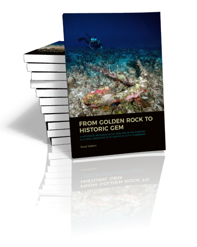
From Golden Rock to Historic Gem
A Historical Archaeological Analysis of the Maritime Cultural Landscape of St. Eustatius, Dutch Caribbean
Ruud Stelten | 2019
Paperback ISBN: 9789088907890 | Hardback ISBN: 9789088907906 | Imprint: Sidestone Press Dissertations | Format: 182x257mm | 230 pp. | Language: English | 11 illus. (bw) | 54 illus. (fc) | Keywords: maritime archaeology; Caribbean; St. Eustatius; colonial archaeology; underwater archaeology; slavery | download cover
Read online or downloaded 597 times
-
Digital & Online access
This is a full Open Access publication, click below to buy in print, browse, or download for free.
-
Buy via Sidestone (EU & UK)
-
Buy via our Distributors (WORLD)
For non-EU or UK destinations you can buy our books via our international distributors. Although prices may vary this will ensure speedy delivery and reduction in shipping costs or import tax. But you can also order with us directly via the module above.
UK international distributor
USA international distributor
-
Bookinfo
Paperback ISBN: 9789088907890 | Hardback ISBN: 9789088907906 | Imprint: Sidestone Press Dissertations | Format: 182x257mm | 230 pp. | Language: English | 11 illus. (bw) | 54 illus. (fc) | Keywords: maritime archaeology; Caribbean; St. Eustatius; colonial archaeology; underwater archaeology; slavery | download cover
Read online or downloaded 597 times

We will plant a tree for each order containing a paperback or hardback book via OneTreePlanted.org.
St. Eustatius, a small island in the northeastern Lesser Antilles, was one of the busiest ports in the eighteenth-century Atlantic World. Contested between the Dutch, French, and English, the island attracted thousands of ships a year and became one of the most cosmopolitan places in the New World. Moreover, the island played an important role in the American War of Independence (1775-1783), during which large quantities of arms, ammunition, and gunpowder were shipped to the fledgling United States through St. Eustatius.
Relics of this turbulent past are found all over the island and in its surrounding waters. These include warehouses in the historic port district, fortifications all around the island, sugar plantations in the countryside, and a variety of underwater archaeological sites such as shipwrecks, anchorage areas, and docks.
Through extensive archaeological and documentary research, this study aims to provide a detailed analysis of the maritime cultural landscape of St. Eustatius over the past four centuries. It focuses on bridging the gap between the marine and terrestrial worlds and demonstrates that in order to truly make sense of the complex interactions, events, and processes that shaped this maritime world, both land and sea need to be studied in relation to each other.
Acknowledgements
1. Introduction
1.1 Natural and environmental setting
1.2 Historical setting
1.3 Previous research
1.4 Research problem
2. Theoretical Framework
2.1 The development of theory in maritime archaeology
2.2 The maritime cultural landscape
2.3 The place of shipwrecks in the maritime cultural landscape
3. Research Methodology
3.1 Underwater archaeological research
3.1.1 Geophysical survey methods
3.1.2 SCUBA diving survey
3.2 The documentary record
3.2.1 Maps, charts, and artwork
3.2.2 Photographs
3.2.3 Wills, deeds, and probate inventories
3.2.4 Traveler’s accounts and ship logs
3.2.5 Newspapers
3.2.6 Public records
4. Economic Components
4.1 The commercial component
4.1.1 Lower Town
4.1.1.1 Archaeological research in Lower Town
4.1.2 Plantations
4.2 The transport and communication component
4.2.1 The roadstead
4.2.1.1 Documentary evidence
4.2.1.2 Archaeology
4.2.2 Shipwrecks
4.2.2.1 Documentary evidence
4.2.2.2 Shipwrecks in St. Eustatius’ archaeological record
4.2.3 From sea to shore
4.2.4 Discussion
4.3 The resource component
4.3.1 Water supply
4.3.2 Provisioning grounds
4.3.3 Fishing
4.3.4 Animal husbandry
4.3.5 Imports
4.4 Conclusions
5. Social Components
5.1 The civic component
5.1.1 Upper Town
5.1.2 Lower Town
5.1.3 Plantations
5.1.4 The roadstead
5.2 The cognitive component
5.2.1 Place names
5.2.2 Religious buildings
5.2.3 The deceased
5.3 The recreative component
5.3.1 Alcohol consumption
5.3.2 Smoking
5.3.3 Parties
5.3.4 Tours and picnics
5.4 Conclusions
6. Political Components
6.1 The defense component
6.1.1 The first fort
6.1.2 A ring of fortifications
6.1.3 The year 1781
6.1.4 Safety on the roadstead
6.2 The power component
6.2.1 Moveable objects
6.2.2 Plantations
6.2.3 Johannes de Graaff
6.2.4 Cemeteries
6.2.5 Military installations
6.3 Conclusions
7. Discussion
7.1 Differing timescales
7.1.1 The defense component
7.1.2 The commercial component
7.1.3 The power component
7.1.4 The resource component
7.1.5 The cognitive component
7.1.6 The civic component
7.1.7 The transport and communication component
7.1.8 The recreative component
7.2 The natural environment
7.2.1 The civic and commercial components
7.2.2 The recreative component
7.2.3 The transport and communication component
7.2.4 The defense and power components
7.2.5 The resource component
7.2.6 The cognitive component
7.3 Overlapping components
7.4 Regional and global context
7.4.1 Shipping and trade
7.4.2 St. Thomas and St. Barths
7.4.3 Bermuda
7.4.4 British North America
8. Conclusion
Bibliography
Appendix I: Bathymetric map
Appendix II: Side scan sonar survey area
Appendix III: Underwater survey transects
Appendix IV: Underwater archaeological sites and artifacts
Appendix V: Extent of the roadstead
Appendix VI: Shipwreck site drawings, 1987-1988
Appendix VII: Text reference locations

Dr. Ruud Stelten
Ruud Stelten is a maritime archaeologist. Born in the Netherlands in 1986, Ruud obtained bachelors and masters degrees in archaeology from Leiden University in 2009 and 2010, focusing on maritime archaeology in the Dutch Caribbean. He obtained his Ph.D. in 2019, focusing on the maritime cultural landscape of St. Eustatius.
Abstract:
St. Eustatius, a small island in the northeastern Lesser Antilles, was one of the busiest ports in the eighteenth-century Atlantic World. Contested between the Dutch, French, and English, the island attracted thousands of ships a year and became one of the most cosmopolitan places in the New World. Moreover, the island played an important role in the American War of Independence (1775-1783), during which large quantities of arms, ammunition, and gunpowder were shipped to the fledgling United States through St. Eustatius.
Relics of this turbulent past are found all over the island and in its surrounding waters. These include warehouses in the historic port district, fortifications all around the island, sugar plantations in the countryside, and a variety of underwater archaeological sites such as shipwrecks, anchorage areas, and docks.
Through extensive archaeological and documentary research, this study aims to provide a detailed analysis of the maritime cultural landscape of St. Eustatius over the past four centuries. It focuses on bridging the gap between the marine and terrestrial worlds and demonstrates that in order to truly make sense of the complex interactions, events, and processes that shaped this maritime world, both land and sea need to be studied in relation to each other.
Contents
Acknowledgements
1. Introduction
1.1 Natural and environmental setting
1.2 Historical setting
1.3 Previous research
1.4 Research problem
2. Theoretical Framework
2.1 The development of theory in maritime archaeology
2.2 The maritime cultural landscape
2.3 The place of shipwrecks in the maritime cultural landscape
3. Research Methodology
3.1 Underwater archaeological research
3.1.1 Geophysical survey methods
3.1.2 SCUBA diving survey
3.2 The documentary record
3.2.1 Maps, charts, and artwork
3.2.2 Photographs
3.2.3 Wills, deeds, and probate inventories
3.2.4 Traveler’s accounts and ship logs
3.2.5 Newspapers
3.2.6 Public records
4. Economic Components
4.1 The commercial component
4.1.1 Lower Town
4.1.1.1 Archaeological research in Lower Town
4.1.2 Plantations
4.2 The transport and communication component
4.2.1 The roadstead
4.2.1.1 Documentary evidence
4.2.1.2 Archaeology
4.2.2 Shipwrecks
4.2.2.1 Documentary evidence
4.2.2.2 Shipwrecks in St. Eustatius’ archaeological record
4.2.3 From sea to shore
4.2.4 Discussion
4.3 The resource component
4.3.1 Water supply
4.3.2 Provisioning grounds
4.3.3 Fishing
4.3.4 Animal husbandry
4.3.5 Imports
4.4 Conclusions
5. Social Components
5.1 The civic component
5.1.1 Upper Town
5.1.2 Lower Town
5.1.3 Plantations
5.1.4 The roadstead
5.2 The cognitive component
5.2.1 Place names
5.2.2 Religious buildings
5.2.3 The deceased
5.3 The recreative component
5.3.1 Alcohol consumption
5.3.2 Smoking
5.3.3 Parties
5.3.4 Tours and picnics
5.4 Conclusions
6. Political Components
6.1 The defense component
6.1.1 The first fort
6.1.2 A ring of fortifications
6.1.3 The year 1781
6.1.4 Safety on the roadstead
6.2 The power component
6.2.1 Moveable objects
6.2.2 Plantations
6.2.3 Johannes de Graaff
6.2.4 Cemeteries
6.2.5 Military installations
6.3 Conclusions
7. Discussion
7.1 Differing timescales
7.1.1 The defense component
7.1.2 The commercial component
7.1.3 The power component
7.1.4 The resource component
7.1.5 The cognitive component
7.1.6 The civic component
7.1.7 The transport and communication component
7.1.8 The recreative component
7.2 The natural environment
7.2.1 The civic and commercial components
7.2.2 The recreative component
7.2.3 The transport and communication component
7.2.4 The defense and power components
7.2.5 The resource component
7.2.6 The cognitive component
7.3 Overlapping components
7.4 Regional and global context
7.4.1 Shipping and trade
7.4.2 St. Thomas and St. Barths
7.4.3 Bermuda
7.4.4 British North America
8. Conclusion
Bibliography
Appendix I: Bathymetric map
Appendix II: Side scan sonar survey area
Appendix III: Underwater survey transects
Appendix IV: Underwater archaeological sites and artifacts
Appendix V: Extent of the roadstead
Appendix VI: Shipwreck site drawings, 1987-1988
Appendix VII: Text reference locations

Dr. Ruud Stelten
Ruud Stelten is a maritime archaeologist. Born in the Netherlands in 1986, Ruud obtained bachelors and masters degrees in archaeology from Leiden University in 2009 and 2010, focusing on maritime archaeology in the Dutch Caribbean. He obtained his Ph.D. in 2019, focusing on the maritime cultural landscape of St. Eustatius.
-
Digital & Online access
This is a full Open Access publication, click below to buy in print, browse, or download for free.
-
Buy via Sidestone (EU & UK)
-
Buy via our Distributors (WORLD)
For non-EU or UK destinations you can buy our books via our international distributors. Although prices may vary this will ensure speedy delivery and reduction in shipping costs or import tax. But you can also order with us directly via the module above.
UK international distributor
USA international distributor
- Browse all books by subject
-
Search all books

We will plant a tree for each order containing a paperback or hardback book via OneTreePlanted.org.
You might also like:
© 2025 Sidestone Press KvK nr. 28114891 Privacy policy Sidestone Newsletter Terms and Conditions (Dutch)


